At a glance
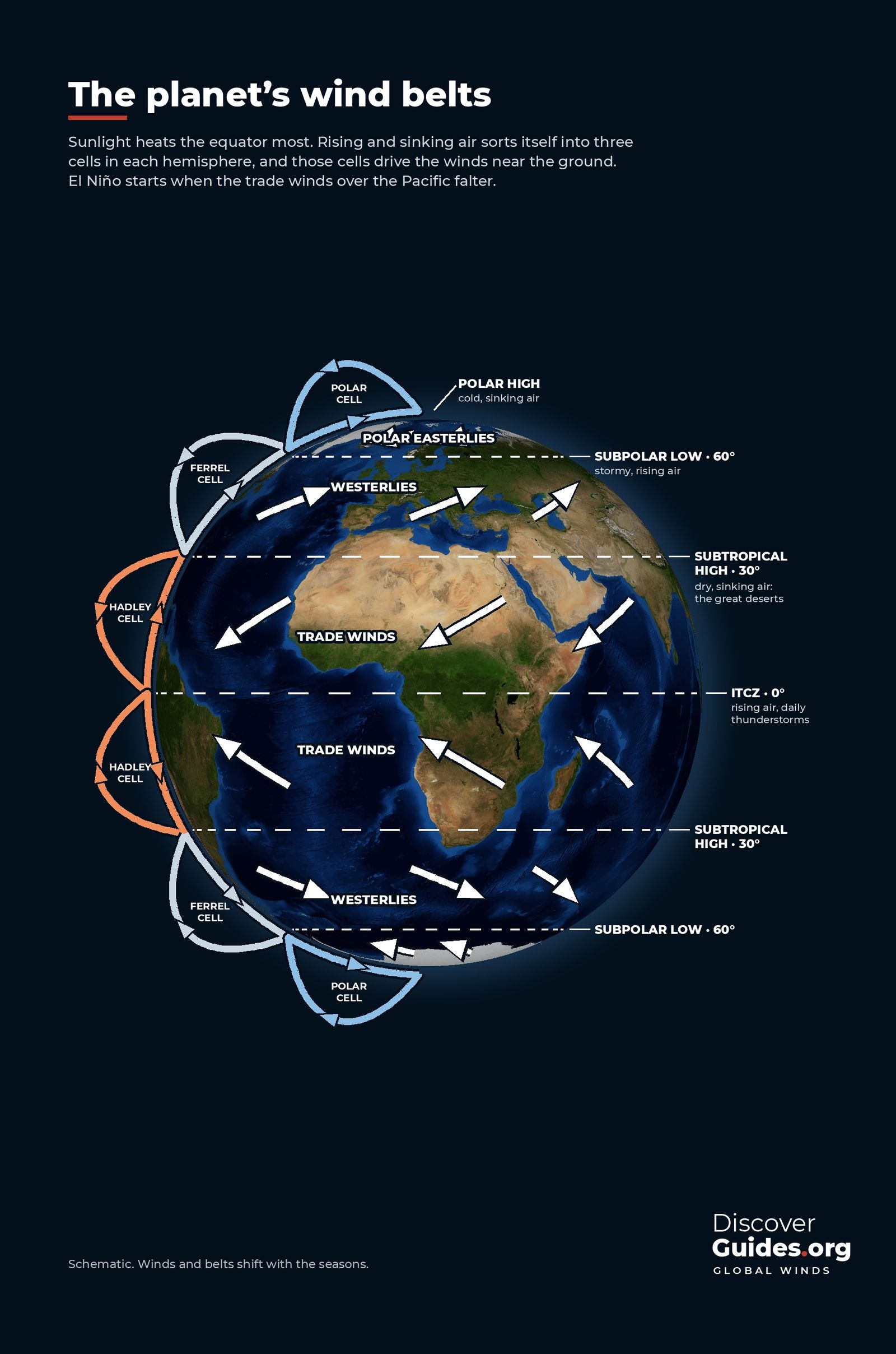
Where the north-east and south-east trade winds meet, air is forced upward along a ragged belt of cloud that wraps around the planet: the Intertropical Convergence Zone, or ITCZ. The UK Met Office notes that storm tops here can reach, and sometimes exceed, 16 km. It is the rising arm of the Hadley cells, the giant loops of air that carry heat from the equator towards the subtropics (see Global Wind Belts Explained).
Why air rises at the equator
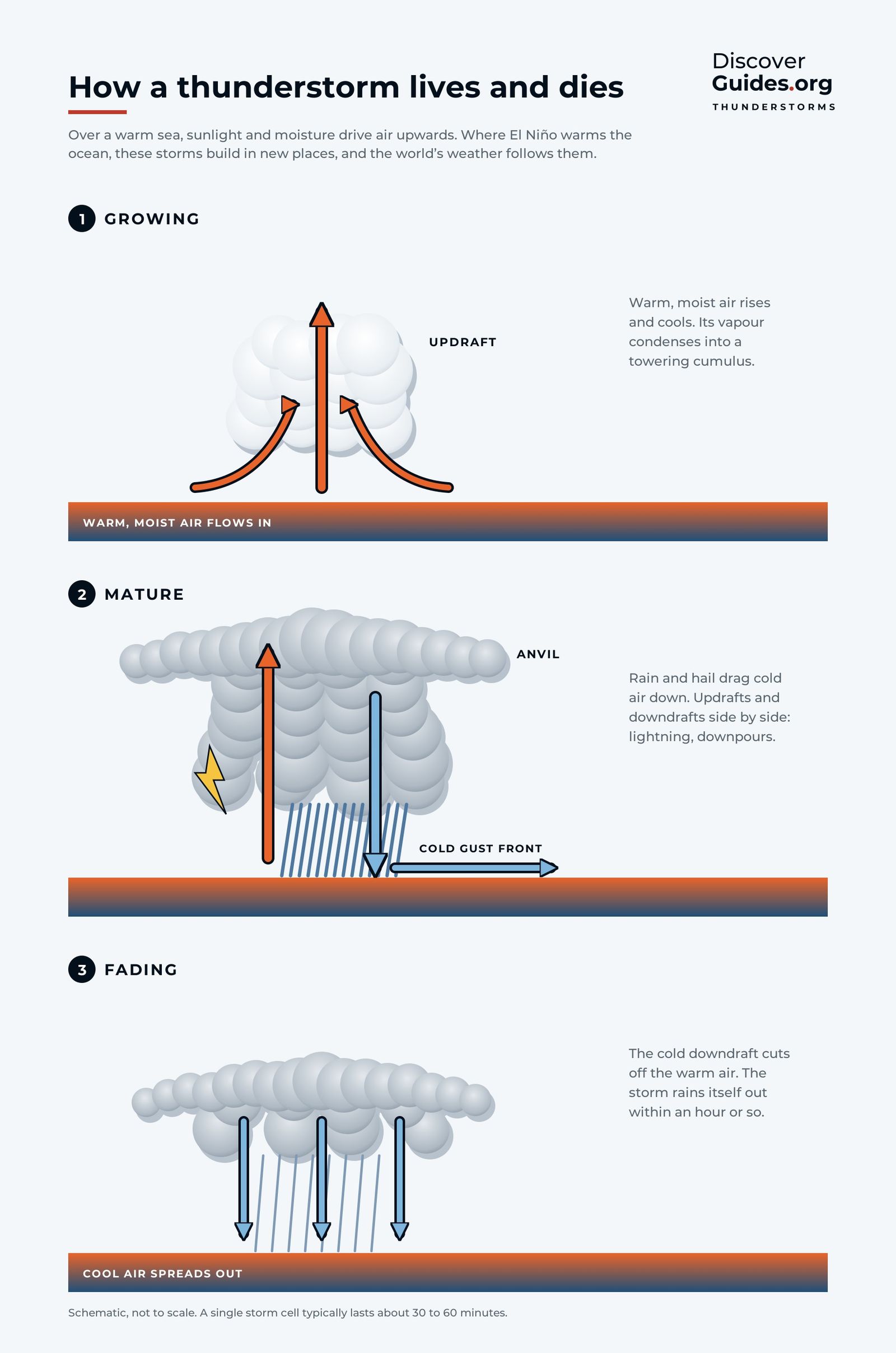
The tropics take in more energy from the Sun than they lose. About a quarter of the solar energy that reaches the planet leaves the surface through evaporation, mostly from warm tropical seas. When that vapour rises, cools and condenses into rain, it releases the heat it absorbed at the sea surface, warming the air high above. Every tropical thunderstorm is therefore a heat pump, lifting energy from the ocean into the upper atmosphere.
The doldrums
Sailors named the belt long before scientists explained it. Where the trade winds meet, the air mostly rises rather than blowing sideways, and ships could sit becalmed for days or weeks. NOAA notes that sailors call this zone, about five degrees either side of the equator, the doldrums. The calm, high-pressure belts at about 30° north and south, where the Hadley cell's air sinks back down, are the horse latitudes, home to the Sahara, Arabia, the Kalahari and the Australian outback.
A belt that follows the Sun
The ITCZ is not fixed. The Met Office notes that it follows the overhead Sun with a delay of about one to two months, swinging further over land than over sea because the ocean warms more slowly. NOAA explains that this migration creates the wet and dry seasons of the tropics. Close to the equator the Sun passes overhead twice a year and many places get two rainy seasons. Further away they merge into one and the climate becomes more monsoonal (see El Niño and the Indian Monsoon).
The ITCZ and El Niño
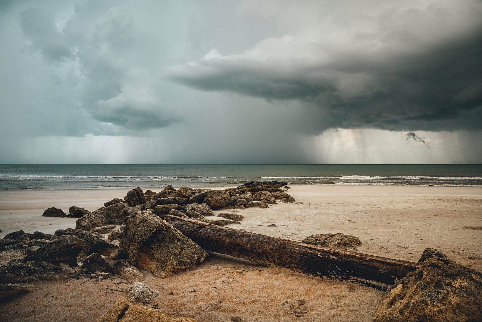
El Niño is, at heart, a shift in where tropical thunderstorms form. In normal years the heaviest rain sits over the warm western Pacific and Indonesia. During El Niño the warm water spreads east and the storms follow it. Climate.gov notes that weak events may only push enhanced rainfall to around the International Date Line, while strong events can drag it all the way to the coasts of Ecuador and Peru.
That is why El Niño can bring floods to the normally dry coast of northern Peru, where the cold Humboldt Current usually keeps the air too stable for rain clouds to grow (see El Niño in Peru: Floods and Fisheries). Shifting the Pacific's storms by thousands of kilometres also bends the jet streams far beyond the tropics (see What Is the Jet Stream?).
| Belt | Approximate latitude | Weather |
|---|---|---|
| ITCZ | About 0°, moving with the seasons | Rising air, daily thunderstorms |
| Subtropical highs | About 30° N and S | Dry, sinking air: the great deserts |
| Subpolar lows | About 50-60° | Stormy, rising air |
| Polar highs | Over the poles | Cold, sinking air |
Questions
What does ITCZ stand for?
Intertropical Convergence Zone: the belt near the equator where the trade winds of the two hemispheres converge and air rises into thunderstorms.
Why is the ITCZ called the doldrums?
Sailors called it the doldrums because the air there mostly rises rather than blowing sideways, so sailing ships could be becalmed for days or weeks.
Does the ITCZ move?
Yes. It follows the overhead Sun with a delay of about one to two months, which creates the wet and dry seasons of the tropics.
How does El Niño affect the ITCZ?
During El Niño the Pacific's heaviest rain shifts east with the warm water, from Indonesia towards the central and eastern Pacific, and in strong events as far as Ecuador and Peru.


