At a glance
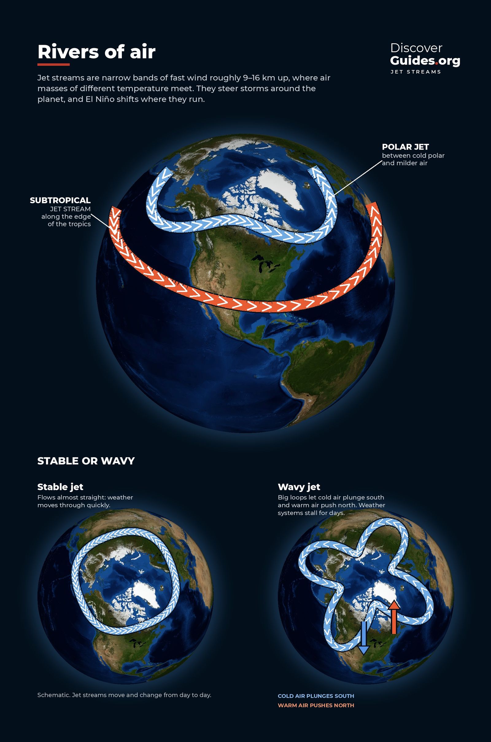
A jet stream is a narrow band of strong wind in the upper troposphere that generally blows from west to east. The US National Weather Service describes two main kinds, a polar jet and a subtropical jet, and each hemisphere has both: four main jet streams in all. They sit roughly where the great circulation cells meet, at the boundaries between warm and cold air (see Global Wind Belts Explained).
Why jet streams exist
Jet streams exist because of temperature contrast. Where warm tropical air meets cold polar air, pressure falls off with height at different rates on either side, and the resulting push, bent sideways by Earth's spin, produces a concentrated core of wind. The bigger the contrast, the stronger the jet, which is why the National Weather Service says jets are strongest in each hemisphere's winter.
| Polar jet | Subtropical jet | |
|---|---|---|
| Typical latitude | About 50-60°, wandering widely | Near 30° |
| Typical height | Around 9 km | Jets range from about 6 to 13 km |
| Forms at | Boundary of polar and mid-latitude air | Poleward edge of the Hadley cell |
| Fastest winds | Usually here, in winter | Generally slower |
Discovered in Esperanto
The first person to measure the jet stream systematically was Wasaburo Ooishi, director of the Aerological Observatory at Tateno, about 60 km north-east of Tokyo. Between March 1923 and February 1925 his team tracked weather balloons through 1,288 observations. On 2 December 1924 they measured a west wind of about 72 m/s, roughly 260 km/h, just below 10 km. Ooishi published in 1926, in Esperanto, and the report went largely unread outside Japan.
The world caught up in late 1944, when American B-29 crews flying to Japan met westerlies they estimated at 160-200 knots. Japan rode the same winds, launching about 9,000 balloon bombs into the jet between November 1944 and April 1945; an estimated 300 reached North America.
Local tipBecause jet streams blow from west to east, NOAA notes that west-to-east flights generally take less time than east-to-west flights on the same route. The UK Met Office is one of only two centres in the world that produce the global aviation charts showing where the jets are.
Straight or wavy
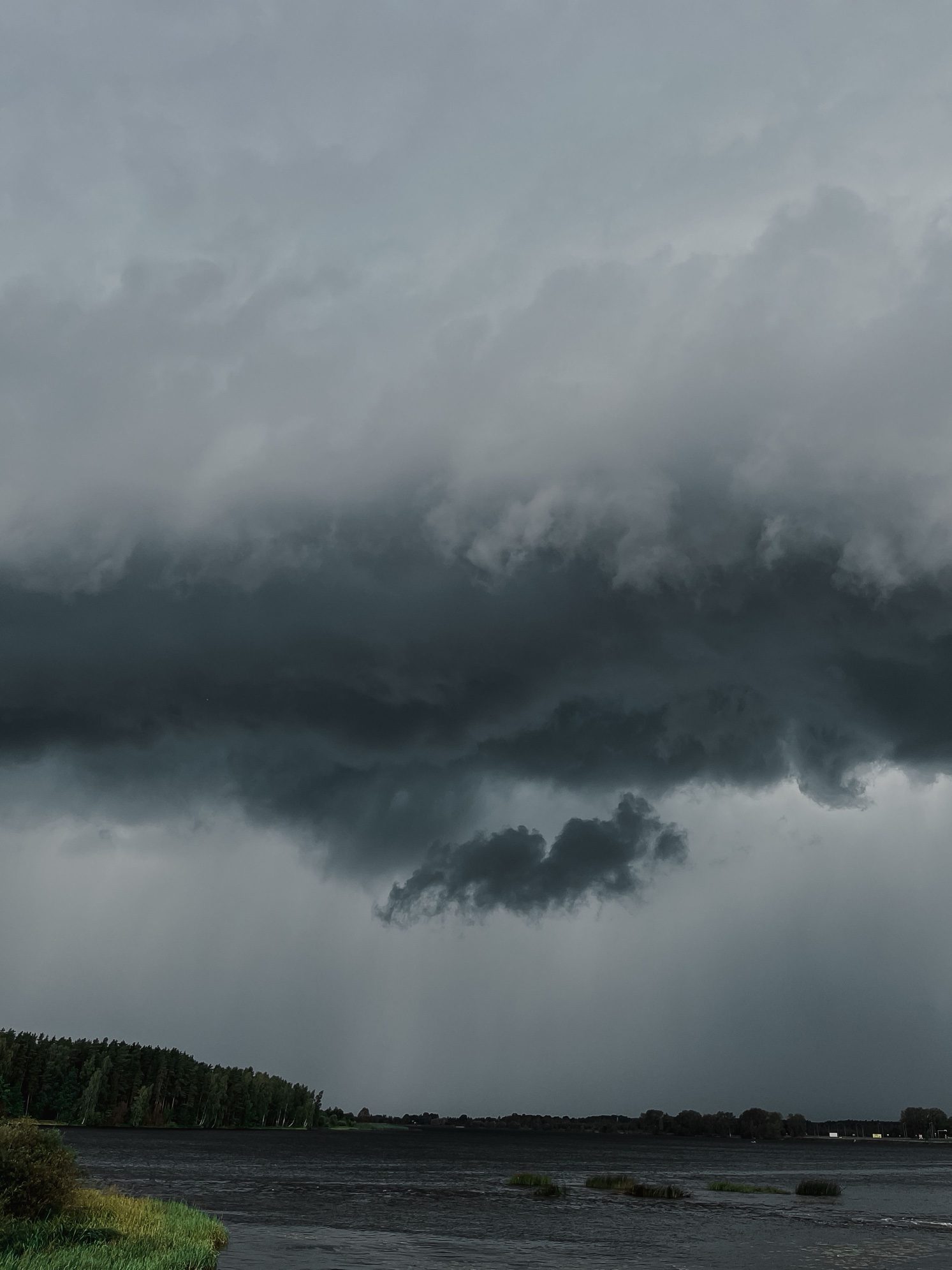
A jet stream is rarely a neat circle around the pole. It meanders like a river, bulging north in places and dipping south in others. These great swings are called Rossby waves. The Met Office compares a straight, fast jet to a swift river carrying a quick succession of storms. When it buckles into deep loops it slows down and weather systems move less predictably. NOAA explains that storms tend to form and travel along the edge of the jet, and that a system left far from it may stall, producing a heat wave or a flood.
How El Niño bends the jet stream
When tropical thunderstorms shift, as they do during El Niño, they heat the upper atmosphere in a new place. NOAA's ENSO blog explains that this forces a ridge of high pressure aloft that launches Rossby waves towards the mid-latitudes, with the jet stream as their highway.
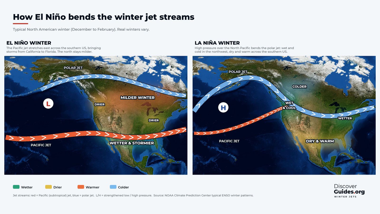
During an El Niño winter the strongest part of the Pacific jet shifts south and stretches farther east, steering storms across the southern third of North America, at times as far as the Gulf of Mexico. During La Niña the jet tends to run from the central Rockies towards the eastern Great Lakes. The details are in El Niño and the Jet Stream.
Questions
What is the jet stream in simple terms?
A jet stream is a narrow band of very fast wind about 9 km up that generally blows from west to east. It forms where warm and cold air meet and steers the storms beneath it.
How fast is the jet stream?
NOAA puts the average at about 177 km/h (110 mph). The National Weather Service says jet stream winds can exceed 442 km/h (275 mph).
How many jet streams are there?
Four main ones: a polar jet and a subtropical jet in each hemisphere.
How does El Niño affect the jet stream?
El Niño tends to shift the Pacific jet south and stretch it east in winter, steering a stormier, wetter winter into the southern United States.


