At a glance
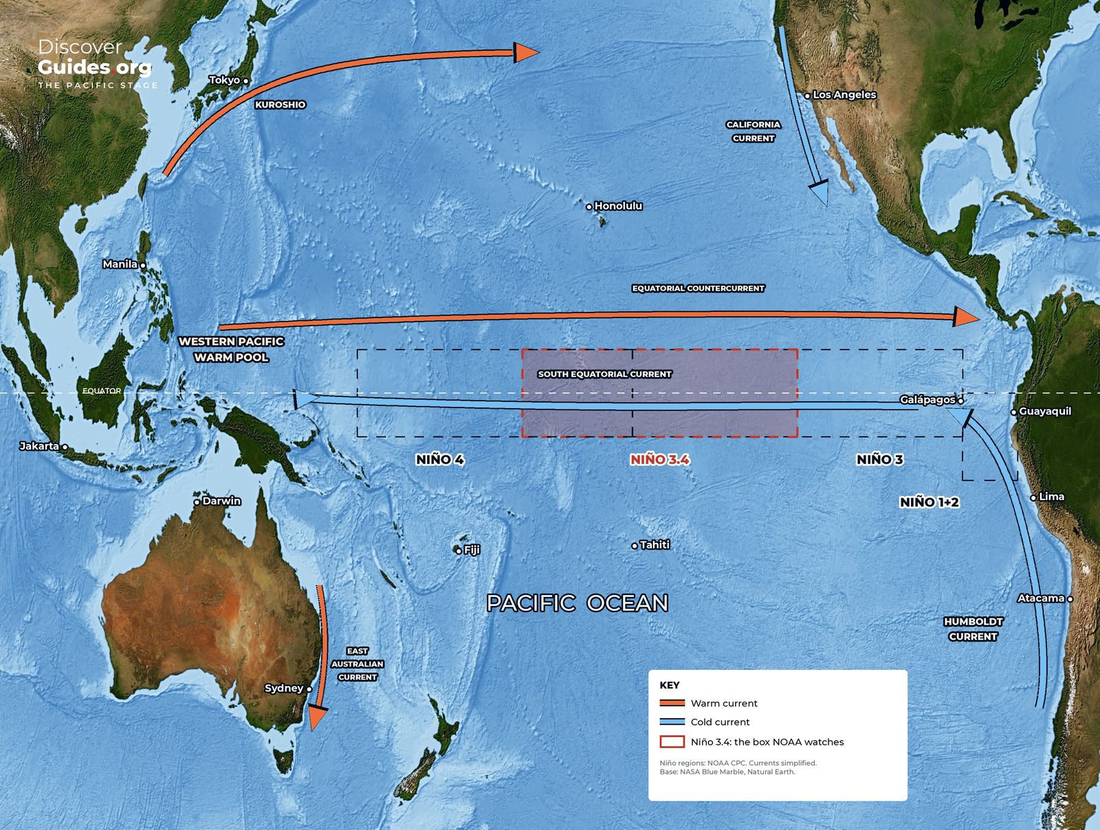
The western tropical Pacific holds the warmest large body of seawater on Earth. NASA describes surface temperatures from about 27 °C at its edges to around 30 °C at its heart, and notes that near about 28.5-29 °C the air above begins to rise rapidly, feeding towering storms. Scientists call it the warm pool. Along the equator in the east, a cold tongue of upwelled water stretches west from South America.
How the loop works
Warm, moist air rises over the warm pool and the Maritime Continent of Indonesia, flows east high in the troposphere, sinks over the cool eastern Pacific, and returns west along the surface as the trade winds. NOAA's Climate.gov describes this as a single great loop along the equator: the Walker circulation.
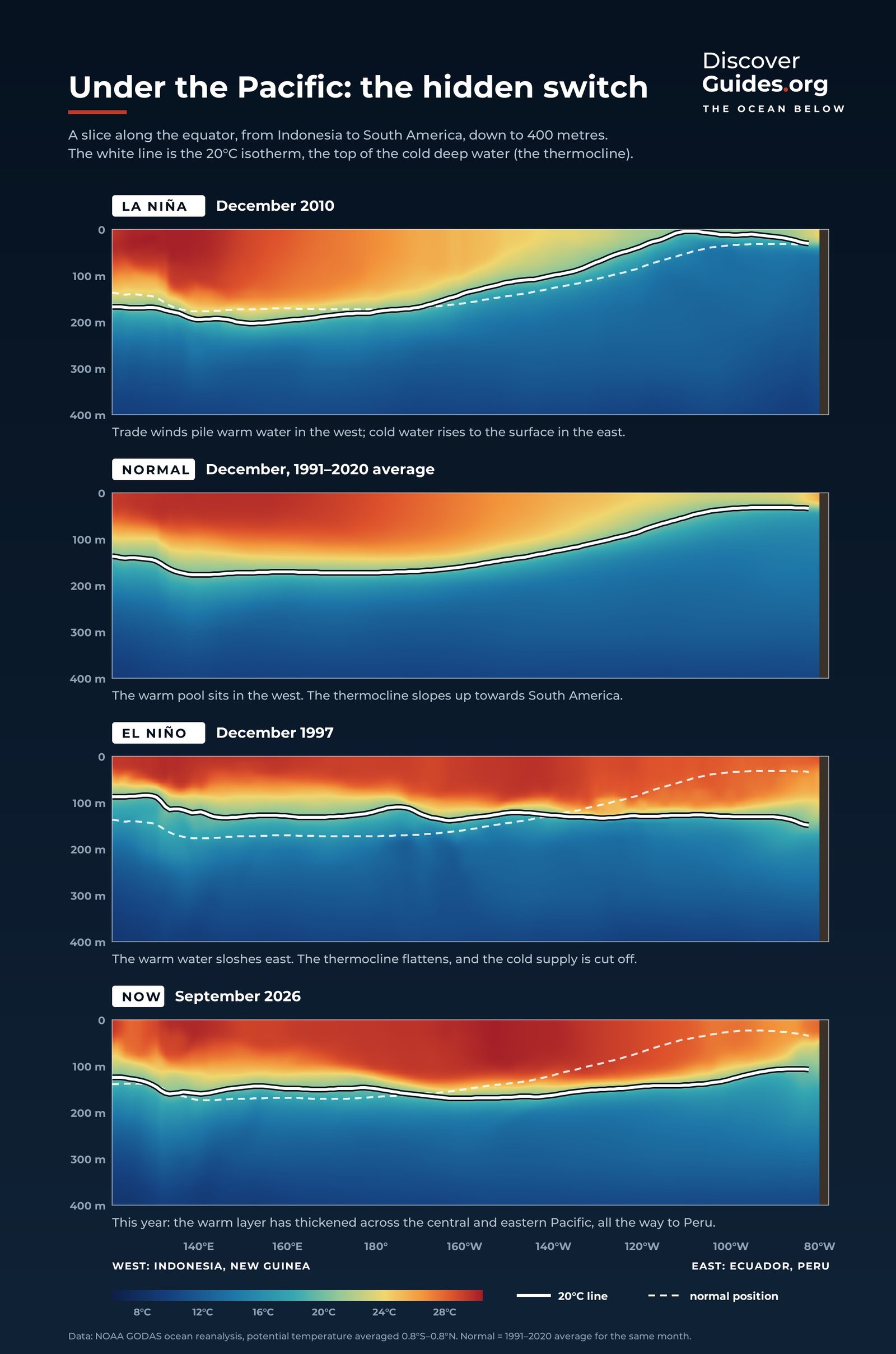
The loop is self-reinforcing. The trade winds pile warm water in the west and lift cold water in the east. That temperature contrast drives rising air in the west and sinking air in the east. The rising and sinking strengthen the trade winds. In a typical December-February, NOAA places the strongest rising branch over the Maritime Continent, with weaker ones over eastern Africa and northern South America, and the strongest sinking over the eastern Pacific.
Who was Walker?
Gilbert Walker was a British mathematician who went to India in 1904 as director-general of observatories, charged with forecasting the monsoon after the great famine of 1899-1900. Searching world weather records for clues, he and his colleagues described a vast see-saw of air pressure across the Indo-Pacific and named it the Southern Oscillation (see Tahiti, Darwin and the See-Saw of the Pacific).
Walker could see the see-saw but could not explain it. The explanation came from the Norwegian meteorologist Jacob Bjerknes, who showed in the late 1960s that the pressure swings and the warm waters off Peru were two faces of one coupled system. In his 1969 paper he named the equatorial loop of air the Walker circulation, in honour of the man who first found its fingerprints.
What El Niño does to the loop
Bjerknes described the Pacific as a chain reaction. A stronger Walker circulation increases the east-west temperature contrast, which in turn strengthens the circulation. Run it backwards and weaker trade winds mean less upwelling, a warmer east, a weaker contrast and weaker winds still. That reverse chain reaction is El Niño (see The Bjerknes Feedback).
| El Niño | La Niña | |
|---|---|---|
| Walker circulation | Weakens; rising branch shifts east | "Turned up to 11" (NOAA Climate.gov) |
| Rain over Indonesia | Weakens; sinking air takes over | Increases |
| Northern South America | Rising air replaced by sinking: drier | Wetter |
| Southern Oscillation Index | Strongly negative | Strongly positive |
Why the whole world feels it
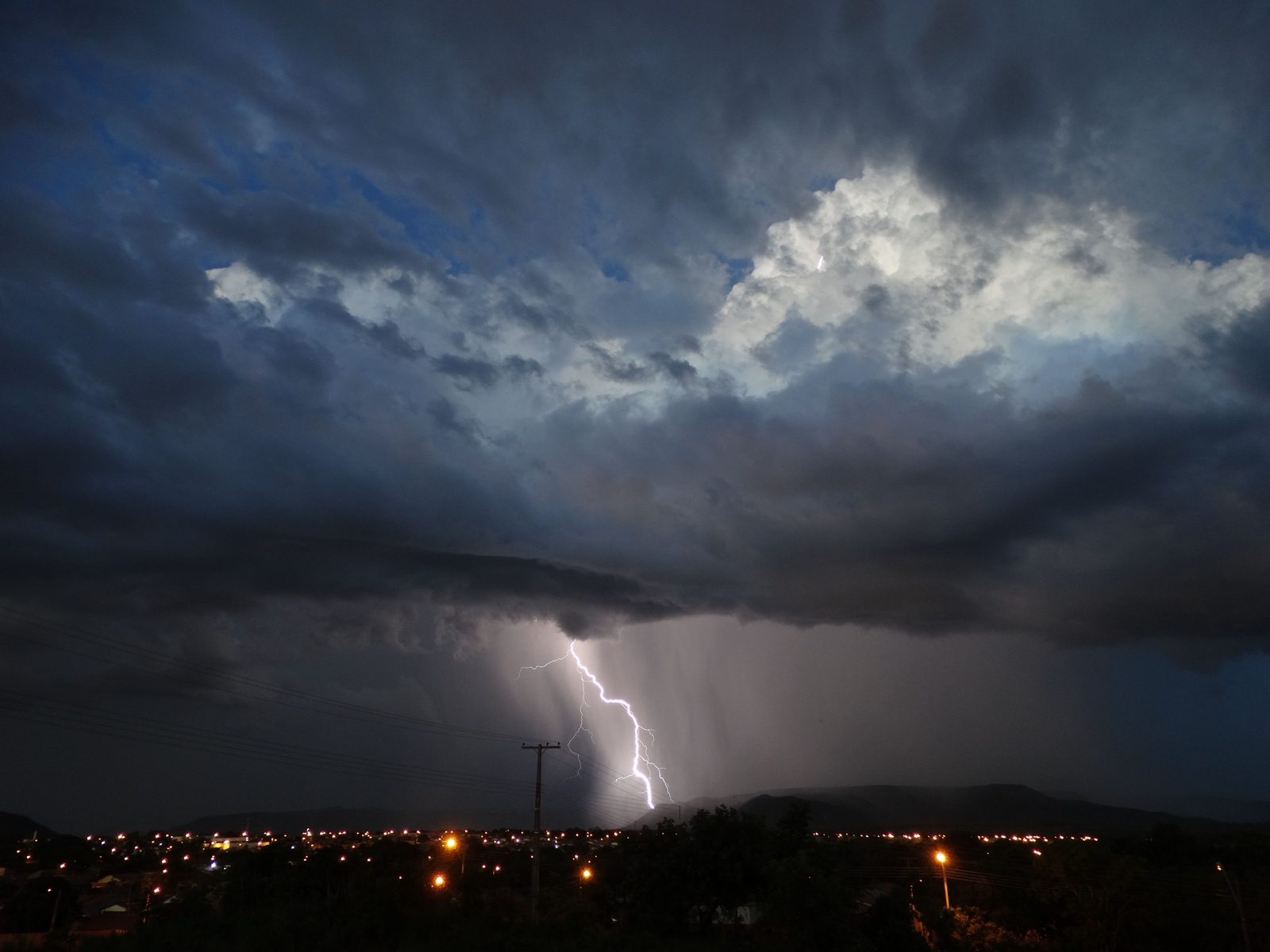
Air that rises in one part of the tropics has to sink somewhere else. When El Niño moves the Pacific's rising air east, dry, sinking air settles over regions that should be wet: Indonesia, parts of South Asia, eastern Australia and southern Africa. The Pacific spans more than 40 per cent of the equator's length, so shifting its rainfall shifts a large share of the heat that the tropics pump into the upper atmosphere. That is the starting point for the long-distance links described in What El Niño Means for Weather Around the World.
Questions
What is the Walker circulation?
It is a loop of air along the equatorial Pacific: air rises over the warm western Pacific and Indonesia, flows east high up, sinks over the cool eastern Pacific and returns west at the surface as the trade winds.
Who named the Walker circulation?
Jacob Bjerknes named it in 1969 after Sir Gilbert Walker, who had discovered the Southern Oscillation, the pressure see-saw that is the loop's surface signature.
What happens to the Walker circulation during El Niño?
It weakens and its rising branch moves east with the warm water. Rain decreases over Indonesia and northern South America and increases over the central and eastern Pacific.
Is the Walker circulation the same as the Hadley cell?
No. The Hadley cells run north-south, carrying heat from the equator towards the subtropics. The Walker circulation runs east-west along the equator.


