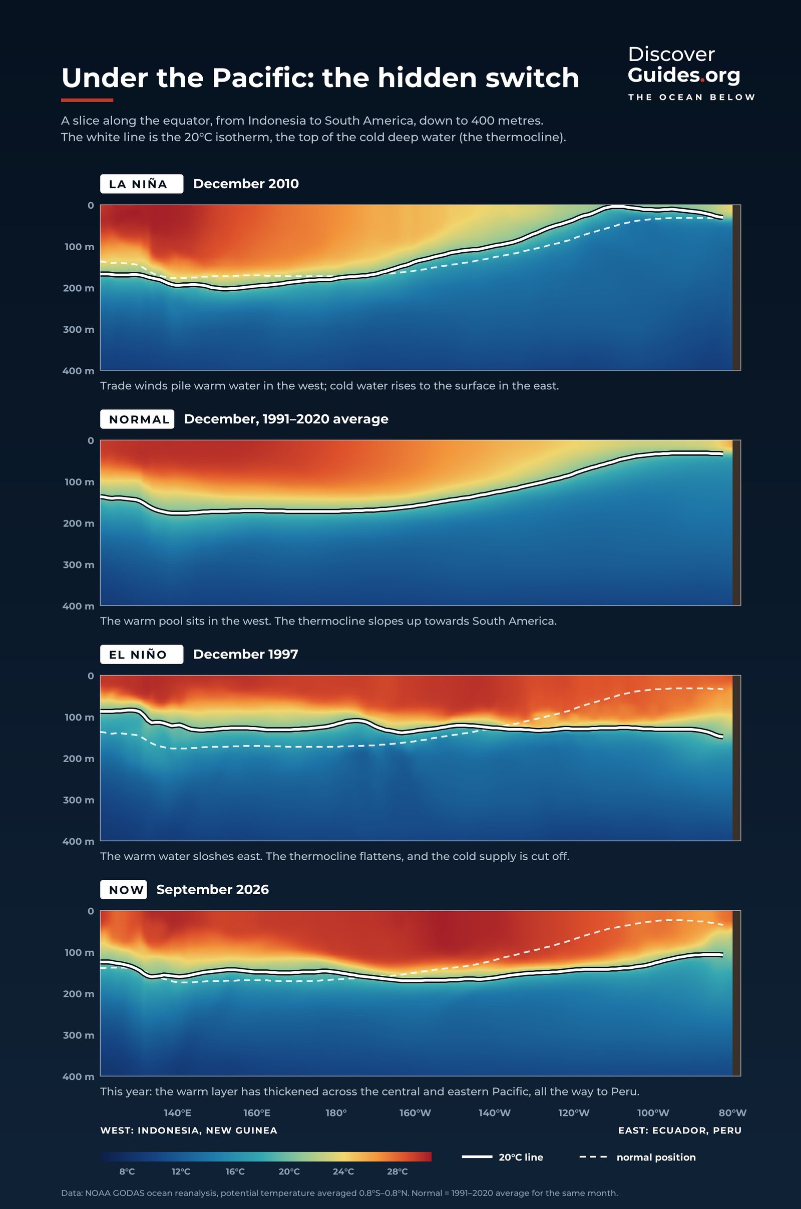
At a glance
Sunlight and waves warm and stir only the top of the ocean. Below this mixed layer lies the thermocline, a transition zone in which temperature drops rapidly with depth into the cold water beneath. NOAA notes that in the deep ocean, below about 1,000 metres, the temperature stays almost constant all the way down to around 4,000 metres.
In the tropics the thermocline is semi-permanent: a sharp lid separating warm water above from cold water below. Oceanographers often mark it by the depth of the 20 °C isotherm, the line where the water is exactly 20 °C.
A tilted lid across the Pacific
The cross-sections at the top of this page slice the equatorial Pacific from Asia to South America in different years. The trade winds blow west along the equator and drag the warm surface layer with them. Over thousands of kilometres the push adds up: according to NOAA, the sea surface stands about half a metre higher at Indonesia than at Ecuador.
Below the surface the tilt is even more dramatic. NOAA's Michael McPhaden describes the thermocline as lying about 150 metres deep in the west and only about 50 metres deep in the east. In the east, cold deep water sits close enough to the surface for the wind to reach it, feeding the cold tongue of water that stretches west from South America. The sloping sea surface and the opposite slope of the thermocline are two sides of the same balance.
What happens to the thermocline in El Niño and La Niña
| Normal | El Niño | La Niña | |
|---|---|---|---|
| Thermocline | Deep in west, shallow in east | Flattens: deeper in the east | Steeper: shallower in the east |
| Eastern upwelling | Steady | Weakens or stops | Strengthens |
| Warmest water | Piled up in the west | Spreads east | Pushed further west |
| Sea off Peru | Cool | Warm | Colder than usual |
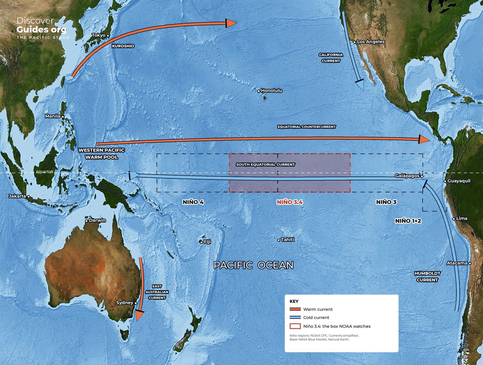
When the trade winds weaken, warm water slides east as a Kelvin wave (see Kelvin Waves Explained) and pushes the eastern thermocline down. The winds can then only stir up warm water, and the eastern Pacific heats up. NOAA recorded that during the 1982-83 event, at 110°W, the 17 °C isotherm dropped to about 150 metres, cutting off the supply of nutrients to the surface. In 1997 a series of Kelvin waves pushed the eastern thermocline down by more than 90 metres.
La Niña does the opposite. Stronger trade winds steepen the tilt, bring the thermocline closer to the surface in the east, and drive stronger, colder upwelling (see El Niño vs La Niña).
The fuel tank of storms and El Niños
The thermocline also measures how much heat the ocean holds. Scientists track the warm water volume: the water warmer than 20 °C lying above the thermocline between 5°S and 5°N, from 120°E to 80°W. Christopher Meinen and Michael McPhaden of NOAA showed in 2000 that this volume swells before El Niño, drains as the event develops, and leads eastern Pacific temperatures by about seven months. Before 1997-98, heat had built in the west for 12 to 18 months.
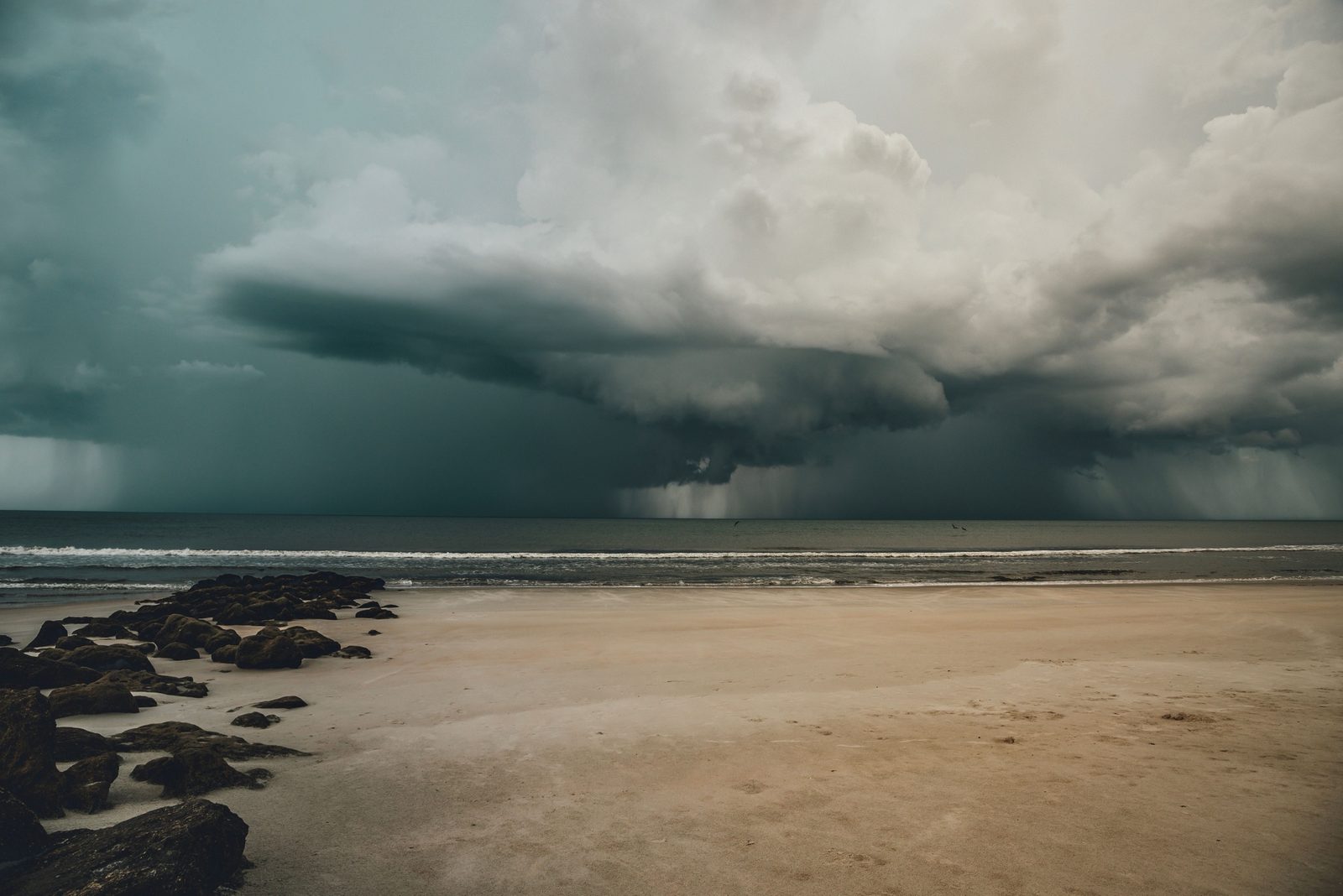
Hurricane forecasters watch the same layer. The depth of warm water above the thermocline is, in NOAA's phrase, the size of a storm's fuel tank: a tropical cyclone needs water of at least about 27 °C reaching roughly 46 metres down, so churning waves cannot simply stir up cold water (see How Hurricanes Work).
A sharper lid in a warmer world
Under greenhouse warming the upper tropical Pacific warms faster than deeper water. That sharpens the boundary between warm surface water and cold water below, making the ocean more sensitive to changes in the winds. Some researchers think this could strengthen ENSO's swings, though climate models still have known weaknesses in the tropical Pacific (see El Niño and Climate Change).
Questions
What is the thermocline?
The thermocline is the layer of the ocean in which temperature drops quickly with depth, separating the warm, mixed surface water from the cold water below. In the tropics it is often marked by the 20 °C line.
How deep is the thermocline in the Pacific?
Along the equator it normally lies about 150 metres deep in the west and about 50 metres deep in the east, according to NOAA.
What happens to the thermocline during El Niño?
It flattens. Warm water spreads east and pushes the thermocline deeper off South America, so upwelling brings up warm instead of cold water and the surface heats up.
Why does the thermocline matter for fishing?
When it is shallow, winds can lift cold, nutrient-rich water to the surface and feed huge fisheries. When it sinks, as in El Niño, the nutrient supply is cut off.


